Before they extended Trowbridge Rd East of Harrison in the early 2000's there was another street slightly to the North. (the red line on the map) & Red Cedar Rd was a dead end South of Wilson. The C&O spur (the yellow line) paralleled the GTW until it curved North across campus.

I don't know if it is still visible but in the '90s you could still see the ROW behind the Landscape Architecture building N of Wilson Rd.
My understanding is that if you go back farther, this spur continued N of the power plant and crossed the river near where the current Administration building is.
In the early '80s C&O planned to remove the spur, and the 1225 group moved the engine for a short time off campus to a spot across the GTW from the Amtrak depot http://www.rrpicturearchives.net/showPi ... id=2858037 and then up to Owosso.
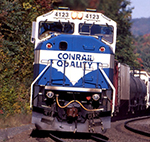
A couple more shots of 1225 on Campus