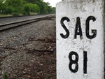
Michael wrote:Within 10 miles of Plymouth. Dirt road crossing. Correction, I guess they are called gravel roads.
Mill St. near Northville. There is no Streetview available at the crossing, but you can see the cell tower just around the corner on Northville Rd.
You nailed it Pixl. I used BING streetview though. Occasionally there are streets that are covered by BING and not by GOOGLE
One of Henry Ford's Village Industries is located at that intersection with an historical marker. It is part of the defunct town of Meads Mills.
I always wonder if they used the railroad.
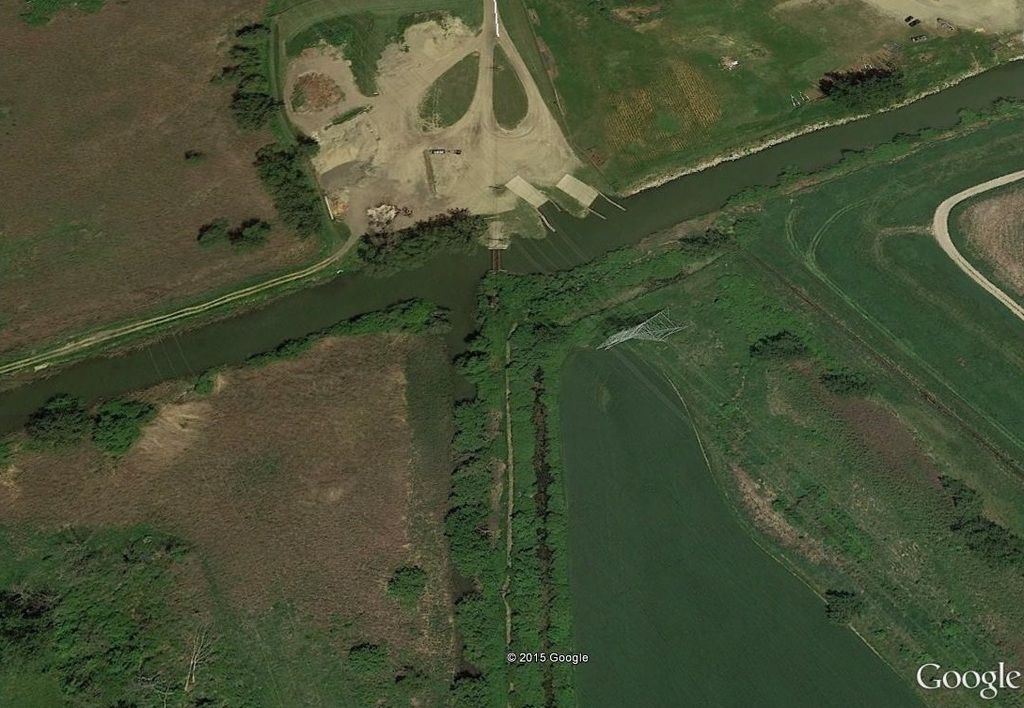
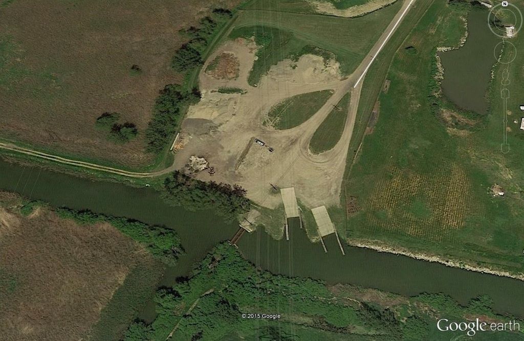
Pixl wrote:See if you can find this SE location and also who's bridge is in the picture.
PatC created a monster, 'cause nobody wants to see Don Simon no more they want AARR I'm chopped liver, well if you want AARR this is what I'll give ya, bad humor mixed with irrelevant info that'll make you roll your eyes quicker than a ~Z~ banhammer...
I think this is in Imlay City north of the CN Flint Sub on GTW's old PollyAnn Cass City Sub.
Michael wrote:
PatC created a monster, 'cause nobody wants to see Don Simon no more they want AARR I'm chopped liver, well if you want AARR this is what I'll give ya, bad humor mixed with irrelevant info that'll make you roll your eyes quicker than a ~Z~ banhammer...
Pixl wrote:See if you can find this SE location and also who's bridge is in the picture.
Here is a slightly different view with true orientation of the photo including the compass. Nearby in this area there three highways and five rail lines that all parallel and run the same NE angle.
Pixl wrote:See if you can find this SE location and also who's bridge is in the picture.
Here is a slightly different view with true orientation of the photo including the compass. Nearby in this area there three highways and five rail lines that all parallel and run the same NE angle.
Crafty changing the orientation like that. Whitewood Creek near Luna Pier.
Pixl wrote:See if you can find this SE location and also who's bridge is in the picture.
Here is a slightly different view with true orientation of the photo including the compass. Nearby in this area there three highways and five rail lines that all parallel and run the same NE angle.
Crafty changing the orientation like that. Whitewood Creek near Luna Pier.[/quote]
Z you got it! Now lets see if someone knows what line ran across the bridge.
Pixl wrote:Now lets see if someone knows what line ran across the bridge.
Good find Pixl. http://bridgehunter.com/mi/monroe/bh65329/
I've got an old topo from 1914 that shows it as Toledo Ottawa & Northern Railroad.
Another source calls it the Toledo Ottawa Beach & Northern Railroad. It probably had other names.
It looks like it was an Interurban that went to about 2 miles further NE to "Toledo Beach"
Where be it? Spur ran across this street, along the grass paralleling the trees, and to the building in the background. Compass included http://i.imgur.com/0y1Szza.jpg
~Z~ wrote:Where be it? Spur ran across this street, along the grass paralleling the trees, and to the building in the background. Compass included http://i.imgur.com/0y1Szza.jpg
Z,
This has been up for about a day now, no finders or keepers yet. Clue time maybe?
~Z~ wrote:Where be it? Spur ran across this street, along the grass paralleling the trees, and to the building in the background. Compass included http://i.imgur.com/0y1Szza.jpg
Z,
This has been up for about a day now, no finders or keepers yet. Clue time maybe?
Surely. Located in either Holland or Grand Rapids, or on the CSX line that connects the two. Spur was attached to CSX. CSX mainline about 100 feet behind the photo.