TC Man wrote:GLC at parsons and Hastings. Consumer Power.
TC, you are correct. I have driven past this for 37 years and just recently spotted the buffer stop out in the yard. I thought hmmnn.. maybe no one else has noticed either, wrong.
Any idea why Consumers Power has several boats in the yard??
TC Man wrote:GLC at parsons and Hastings. Consumer Power.
TC, you are correct. I have driven past this for 37 years and just recently spotted the buffer stop out in the yard. I thought hmmnn.. maybe no one else has noticed either, wrong.
Any idea why Consumers Power has several boats in the yard??
The boats are not Consumers Power property. If you drive down Hastings you will see that there are businesses landlocked between Hastings and the Consumers property Wichita basically runs North\South behind those other businesses.
CEO of the Waving Institute- teaching great wave forms.
Pixl wrote:Try this East Michigan location. Camera is looking SW.
Holy overuse of the shadows/highlights tool, Batman!
https://www.flickr.com/photos/jimthias/
GRHC - you know every night I can imagine he is in front of his computer screen sitting in his underwear swearing profusely and drinking Blatz beer combing the RailRoadFan website for grammatical errors.
Today we welcome michiganrailroads visitors.
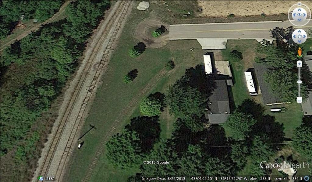
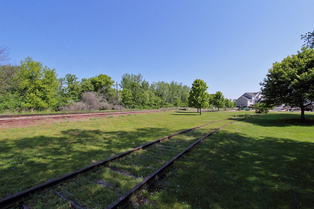
Is that a depot I spy? Plus a spur leading to a bush... sources say this spur went further than that bush http://i.imgur.com/p345e8V.jpg
Found it with Google Earth and a lucky guess. You are at the West end of Adams St., Grand Haven. PM depot in the background.
That bush would not make much of a buffer stop!
Well then, I guess I won't be posting this photo for a Where Am I? Took this a few months ago when I was photographing a house near the end of that dead end street.
~Z~ wrote: Plus a spur leading to a bush... sources say this spur went further than that bush
Yes, that spur went a mile or so east to some industries, crossing US 31 just north of Adams St.
https://www.flickr.com/photos/jimthias/
GRHC - you know every night I can imagine he is in front of his computer screen sitting in his underwear swearing profusely and drinking Blatz beer combing the RailRoadFan website for grammatical errors.
Art Million once told me that as a kid he used to ride along sometimes on the C&O switching job that ran across US31 in Grand Haven. There was a slaughterhouse or a rendering plant on the far side, so there was often an open gondola full of stinking offal being pushed ahead of the caboose. If the conductor who liked him was on the train, Art got to ride in the caboose. If the conductor who didn't like him was on the train, Art had to ride outside on the caboose's end platform, next to the offal car.
J T wrote:Well then, I guess I won't be posting this photo for a Where Am I? Took this a few months ago when I was photographing a house near the end of that dead end street.
~Z~ wrote: Plus a spur leading to a bush... sources say this spur went further than that bush
Yes, that spur went a mile or so east to some industries, crossing US 31 just north of Adams St.
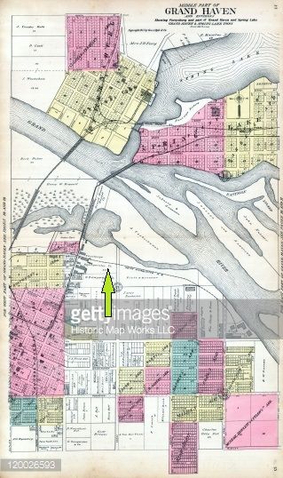
I did a little research on this today (hey it rained all day, nothing else to do). I found an old map that shows the spur running along Adams St. then curving South to some industry. The map is is in low quality and you can barely read some of the street names.
Looks as though PM and GTW used the same bridge to cross into Grand Haven, yet each railroad had separate depots and rail yards near each other.
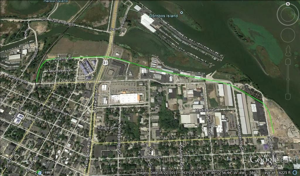
I retraced the approximate route on Google Earth shown here in green. The end property today appears to be a scrap yard.
Holy overuse of the shadows/highlights tool, Batman!
I ripped the image from the net somewhere. Not my work, but it looked better than the StreetView image I found it with.
I thought the image looked doctored a bit.
Track to the right is a spur, and the track that goes straight is now about as long as the spur to the right, although the straight track used to continue for many more miles.
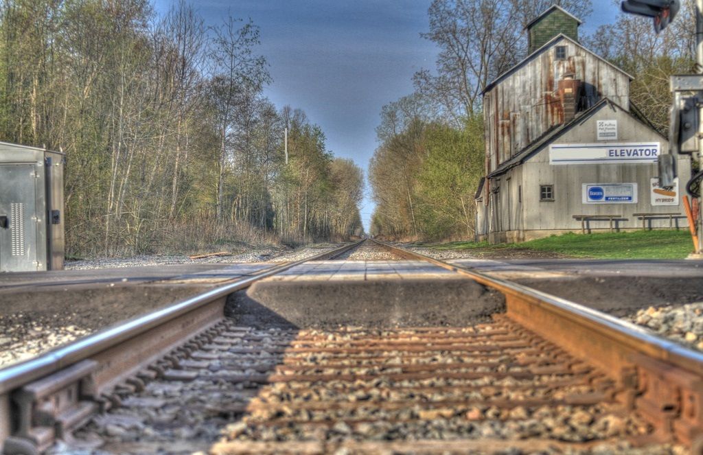
That would be Gaylord next to the entrance of the North Central State Trail on Fairview Rd. On aerial photos it appears that there is now an additional building to the right of the tracks.
J T wrote:Well then, I guess I won't be posting this photo for a Where Am I? Took this a few months ago when I was photographing a house near the end of that dead end street.
~Z~ wrote: Plus a spur leading to a bush... sources say this spur went further than that bush
Yes, that spur went a mile or so east to some industries, crossing US 31 just north of Adams St.
I did a little research on this today (hey it rained all day, nothing else to do). I found an old map that shows the spur running along Adams St. then curving South to some industry. The map is is in low quality and you can barely read some of the street names.
Looks as though PM and GTW used the same bridge to cross into Grand Haven, yet each railroad had separate depots and rail yards near each other.
I retraced the approximate route on Google Earth shown here in green. The end property today appears to be a scrap yard.
Anyone know the area?
The end of the line you are talking about was Eagle Ottawa Leather that just finnished being demolished. There is now a high dollar campground (rv resort). You can still see the tracks along the drive between Walgreens and Applebees. Rycenga lumber was a customer further down and may still have some rail in place. Grand Valley marina still has rail in the pavement along their west building. All the tracks east of Grand Valley marina were torn out when Grand Haven Storage was built. It seems that the Rail still crossed us31 even after they had pulled up most of it to the east. I remember huge cantilever signal bridge and huge paver markings for years.
Pixl wrote:I retraced the approximate route on Google Earth shown here in green. The end property today appears to be a scrap yard.
Anyone know the area?
The end of the line you are talking about was Eagle Ottawa Leather that just finnished being demolished. There is now a high dollar campground (rv resort). You can still see the tracks along the drive between Walgreens and Applebees. Rycenga lumber was a customer further down and may still have some rail in place. Grand Valley marina still has rail in the pavement along their west building. All the tracks east of Grand Valley marina were torn out when Grand Haven Storage was built. It seems that the Rail still crossed us31 even after they had pulled up most of it to the east. I remember huge cantilever signal bridge and huge paver markings for years.
EW, thanks for putting up that info on this subject. I think the campground would be a clean and green use of the site, I hope it goes thru. I read about the usual opposition you find with ANY project, aways some idiots out there. I would like to camp there some day. I am not concerned about ground contamination, don't plan to lay face down on the soil.
Pixl wrote:I would like to camp there some day. I am not concerned about ground contamination, don't plan to lay face down on the soil.
That's the funniest thing I've read all day.
https://www.flickr.com/photos/jimthias/
GRHC - you know every night I can imagine he is in front of his computer screen sitting in his underwear swearing profusely and drinking Blatz beer combing the RailRoadFan website for grammatical errors.
Pixl wrote:I would like to camp there some day. I am not concerned about ground contamination, don't plan to lay face down on the soil.
That's the funniest thing I've read all day.
You may be better off sticking your face in the dirt. About 100 yards to the south east of the campground is the wastewater treatment plant for Grand Haven and parts of northern Ottawa county. This facility can be RIPE on the right days. But the resort, I mean campground, doesn't look like the "rustic" type. More like turn on your AC and watch tv, or go downtown type of campground. Everybody has there own thing. I'll take Isle Royal, a canoe and backpack.
EWRice wrote:But the resort, I mean campground, doesn't look like the "rustic" type. More like turn on your AC and watch tv, or go downtown type of campground.
Exactly the kind of camping I like.
When we want to go rustic, we turn off the AC and the TV. Ummn.. nah.
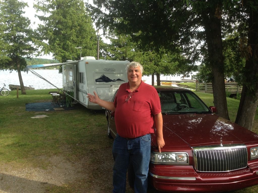
Here is Central Lake this past August where we were suffering with no cable, had to use the OTA antenna. Well they did provide WiFi.
Yes the 1996 Lincoln Town car pulls the 27 ft. camper just fine. Big engine, rear wheel drive, who needs a truck!
Never underestimate the full size American made cars. I owned two that I would use to pull anything a truck could. My 68 Cadillac has a bigger engine than any production pickup, the same trans as my 1 ton work truck and a rear axle equivalent to a c clip 3/4 ton truck. My 84 Pontiac Parisienne had a 403 Olds engine and trailer brakes. The suspension was a bit soft for heavy towing on that one.
Mark F wrote:That would be Gaylord next to the entrance of the North Central State Trail on Fairview Rd. On aerial photos it appears that there is now an additional building to the right of the tracks.
That's the LSRC on the north side of Gaylord looking north.
Mark F wrote:That would be Gaylord next to the entrance of the North Central State Trail on Fairview Rd. On aerial photos it appears that there is now an additional building to the right of the tracks.