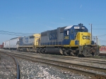
Yesterday’s adventure of exploring downtown Allegan made me trace the former PM into town, abandoned in 1979. I also got lucky and caught 702 working the Co-op as well but it left me with some questions.
First one is in Hamilton just north of the trestle over the Rabbit River. There appears to be an old foundation for a building as well as a buried spur that is sticking up out of the ground on the west side of the line. The lot is all overgrown, but looks mostly undisturbed. Anyone have a clue as to what this was? It’s between a house and the road leading down to the park that many people take photos of the trestle from on the West Side of the line.
Does anyone have any photos or track layout when the Chessie served the customer just south of the Hamilton Co-op? It appears their building is still there just south of a storage lot and the current end of Track. I also have not seen a single milepost on the Hamilton Branch, so I have no clue as to where the railroad starts on paper and where it ends.
Now Allegan:
After the PM comes in from the Northwest I know they met the NYC near the current day streets of Briggs and Depot Hill Ct. I also understand they had some trackage going into downtown as well as maybe a small stretch of street running? I’m also curious if the NYC stayed on the east side of town or had any industrial trackage with the PM in or around both sides of the Kalamazoo River? Does anyone have any photos or track diagrams? Development seems to have destroyed a lot of the PM in and around town but left the NYC for the most part intact. I’d love to find bits and pieces of the PM’s past in Allegan if there’s any buried or hidden in plain sight.
I also see zero trace of the Interurban ROW that was abandoned in the 20’s. Has anyone ever been able to detect the interurban grade anywhere between Martin and Allegan?
Hamilton/Allegan Abandoned ROW Q&A
-
MQT1223
- O Scale Railfanner
- Posts: 4210
- Joined: Wed Sep 10, 2014 1:46 pm
- Location: Grandville, Michigan
- Contact:
Hamilton/Allegan Abandoned ROW Q&A
1223 OUT! President and Founder of the Buck Creek Central, the Rolling River Route! (2012-2017) President and Founder of the Lamberton Valley Railroad, The Tin Plate Road! Proudly railfanning with Asperger's since 1996. 
-
Tankcar123
- Railroadfan...fan
- Posts: 146
- Joined: Sat May 28, 2016 9:46 am
- Location: Wayland, MI
Re: Hamilton/Allegan Abandoned ROW Q&A
In Hamilton there was an old feed mill at the north end of the trestle. It was torn down sometime in the 60's I think. Probably the cement foundation and tracks are still left over from that.
The south end of the trestle is mp13, tracks end now at approx mp12.5
The south end of the trestle is mp13, tracks end now at approx mp12.5
-
~Z~

- Sofa King Admin
- Posts: 13192
- Joined: Tue Oct 12, 2004 2:14 pm
- Location: Grand Rapids, MI
- Contact:
Re: Hamilton/Allegan Abandoned ROW Q&A
MP17 is in the middle of the Hamilton branch, located at Fillmore Rd:
https://railpictures.net/photo/362100/
Webmaster
Railroad photos on Railroadfan.com
Railroad photos on Railroadfan.com
-
MQT1223
- O Scale Railfanner
- Posts: 4210
- Joined: Wed Sep 10, 2014 1:46 pm
- Location: Grandville, Michigan
- Contact:
Re: Hamilton/Allegan Abandoned ROW Q&A
Guess I never noticed that.~Z~ wrote: ↑Wed Jan 20, 2021 10:23 amMP17 is in the middle of the Hamilton branch, located at Fillmore Rd:
https://railpictures.net/photo/362100/
1223 OUT! President and Founder of the Buck Creek Central, the Rolling River Route! (2012-2017) President and Founder of the Lamberton Valley Railroad, The Tin Plate Road! Proudly railfanning with Asperger's since 1996.
-
Standard Railfan

- Railroadfan...fan
- Posts: 1824
- Joined: Wed Jan 18, 2012 7:25 pm
- Location: Marquette, MI
Re: Hamilton/Allegan Abandoned ROW Q&A
This might help: http://www.historicmapworks.com/Map/US ... /Michigan/MQT1223 wrote: ↑Wed Jan 20, 2021 8:27 am
Now Allegan:
After the PM comes in from the Northwest I know they met the NYC near the current day streets of Briggs and Depot Hill Ct. I also understand they had some trackage going into downtown as well as maybe a small stretch of street running? I’m also curious if the NYC stayed on the east side of town or had any industrial trackage with the PM in or around both sides of the Kalamazoo River? Does anyone have any photos or track diagrams? Development seems to have destroyed a lot of the PM in and around town but left the NYC for the most part intact. I’d love to find bits and pieces of the PM’s past in Allegan if there’s any buried or hidden in plain sight.
I also see zero trace of the Interurban ROW that was abandoned in the 20’s. Has anyone ever been able to detect the interurban grade anywhere between Martin and Allegan?
As might this: https://www.loc.gov/resource/g4114am.g ... +Michigan+
Re: Hamilton/Allegan Abandoned ROW Q&A
Oh my those tracks are MAW quality right there~Z~ wrote: ↑Wed Jan 20, 2021 10:23 amMP17 is in the middle of the Hamilton branch, located at Fillmore Rd:
https://railpictures.net/photo/362100/
Re: Hamilton/Allegan Abandoned ROW Q&A
Take a look here, I believe this is the grade. Monteith Jct would be in the field if they had left the tracks intact.
https://www.google.com/maps/@42.5239813 ... 7475468766
I also think it can be seen here
https://www.google.com/maps/@42.5295369 ... 7475468766
here
https://www.google.com/maps/@42.5320849 ... 7475468766
and here
https://www.google.com/maps/@42.5388857 ... 7475468766
Trails to Rails. Put the track back.

Re: Hamilton/Allegan Abandoned ROW Q&A
Wow, they really did rename/realign a lot of the roads over the years.Standard Railfan wrote: ↑Wed Jan 20, 2021 4:20 pm
This might help: http://www.historicmapworks.com/Map/US ... /Michigan/
https://www.flickr.com/photos/jimthias/
GRHC - you know every night I can imagine he is in front of his computer screen sitting in his underwear swearing profusely and drinking Blatz beer combing the RailRoadFan website for grammatical errors.
GRHC - you know every night I can imagine he is in front of his computer screen sitting in his underwear swearing profusely and drinking Blatz beer combing the RailRoadFan website for grammatical errors.
-
Tankcar123
- Railroadfan...fan
- Posts: 146
- Joined: Sat May 28, 2016 9:46 am
- Location: Wayland, MI
Re: Hamilton/Allegan Abandoned ROW Q&A
I think you talking about the business just past the end of the line. It was not there when the railroad was in operation. It's only been there 15-20 years. In fact their driveway is on the old ROW. Across 134th to the south was the Pet Life dog food plant. Tracks ran right behind the building, not sure if they got cars there or not. After the tracks were pull up they expanded their building and built a warehouse on the old ROW.MQT1223 wrote: ↑Wed Jan 20, 2021 8:27 am
Does anyone have any photos or track layout when the Chessie served the customer just south of the Hamilton Co-op? It appears their building is still there just south of a storage lot and the current end of Track. I also have not seen a single milepost on the Hamilton Branch, so I have no clue as to where the railroad starts on paper and where it ends.
-
MQT1223
- O Scale Railfanner
- Posts: 4210
- Joined: Wed Sep 10, 2014 1:46 pm
- Location: Grandville, Michigan
- Contact:
Re: Hamilton/Allegan Abandoned ROW Q&A
[/quote]
Oh my those tracks are MAW quality right there
[/quote]
If you have seen the MAW in person like I have, I can tell you that these don't even come close to the severity of the condition of those tracks. This would look like 70mph track compared to what those guys are used to down there.
Oh my those tracks are MAW quality right there
[/quote]
If you have seen the MAW in person like I have, I can tell you that these don't even come close to the severity of the condition of those tracks. This would look like 70mph track compared to what those guys are used to down there.
Yeah no kidding. I wonder if that's due to Allegan shrinking over the years.J T wrote: ↑Wed Jan 20, 2021 8:43 pmWow, they really did rename/realign a lot of the roads over the years.Standard Railfan wrote: ↑Wed Jan 20, 2021 4:20 pm
This might help: http://www.historicmapworks.com/Map/US ... /Michigan/
1223 OUT! President and Founder of the Buck Creek Central, the Rolling River Route! (2012-2017) President and Founder of the Lamberton Valley Railroad, The Tin Plate Road! Proudly railfanning with Asperger's since 1996.
-
MQT1223
- O Scale Railfanner
- Posts: 4210
- Joined: Wed Sep 10, 2014 1:46 pm
- Location: Grandville, Michigan
- Contact:
Re: Hamilton/Allegan Abandoned ROW Q&A
From what I've read and discussed with other individuals, there was at one point a second shipper in Hamilton after the line was pulled back from Allegan and when they stopped shipping the line was pulled again back to its current terminus. I could be wrong but that was my understanding.Tankcar123 wrote: ↑Thu Jan 21, 2021 8:12 amI think you talking about the business just past the end of the line. It was not there when the railroad was in operation. It's only been there 15-20 years. In fact their driveway is on the old ROW. Across 134th to the south was the Pet Life dog food plant. Tracks ran right behind the building, not sure if they got cars there or not. After the tracks were pull up they expanded their building and built a warehouse on the old ROW.MQT1223 wrote: ↑Wed Jan 20, 2021 8:27 am
Does anyone have any photos or track layout when the Chessie served the customer just south of the Hamilton Co-op? It appears their building is still there just south of a storage lot and the current end of Track. I also have not seen a single milepost on the Hamilton Branch, so I have no clue as to where the railroad starts on paper and where it ends.
1223 OUT! President and Founder of the Buck Creek Central, the Rolling River Route! (2012-2017) President and Founder of the Lamberton Valley Railroad, The Tin Plate Road! Proudly railfanning with Asperger's since 1996.
-
MQT1223
- O Scale Railfanner
- Posts: 4210
- Joined: Wed Sep 10, 2014 1:46 pm
- Location: Grandville, Michigan
- Contact:
Re: Hamilton/Allegan Abandoned ROW Q&A
Amazing how before I saw this post, the old Sanborn map made finding the diamond easier and thus the ROW. I was able to trace it to almost the junction. Didn't Montieth Junction have a tower and flagstop at one point? Did that also include where it crossed the GR&I?Jim_c wrote: ↑Wed Jan 20, 2021 7:55 pmTake a look here, I believe this is the grade. Monteith Jct would be in the field if they had left the tracks intact.
https://www.google.com/maps/@42.5239813 ... 7475468766
I also think it can be seen here
https://www.google.com/maps/@42.5295369 ... 7475468766
here
https://www.google.com/maps/@42.5320849 ... 7475468766
and here
https://www.google.com/maps/@42.5388857 ... 7475468766
1223 OUT! President and Founder of the Buck Creek Central, the Rolling River Route! (2012-2017) President and Founder of the Lamberton Valley Railroad, The Tin Plate Road! Proudly railfanning with Asperger's since 1996.
Re: Hamilton/Allegan Abandoned ROW Q&A
As this map shows, there was not only a station, but also a connecting track. Once you know where the connector was, you might wonder if the trees visible on Google Maps or Google Earth show the arc made by the connector.MQT1223 wrote: ↑Wed Jan 20, 2021 8:27 amAmazing how before I saw this post, the old Sanborn map made finding the diamond easier and thus the ROW. I was able to trace it to almost the junction. Didn't Montieth Junction have a tower and flagstop at one point? Did that also include where it crossed the GR&I?
http://www.historicmapworks.com/Map/US/ ... /Michigan/
Trails to Rails. Put the track back.
-
David Lang
- Railroadfan...fan
- Posts: 1020
- Joined: Thu Nov 24, 2005 9:43 am
Re: Hamilton/Allegan Abandoned ROW Q&A
Hey guys. I just started looking at historicmapworks.com and WOW that is GREAT!!!
I saw railroads not too far from where I grew up South of Battle Creek that I never knew existed in the 1890s!!
Thanks for sharing that link.
David Lang
I saw railroads not too far from where I grew up South of Battle Creek that I never knew existed in the 1890s!!
Thanks for sharing that link.
David Lang
-
tsinoms
- Adult Gerber Baby
- Posts: 1671
- Joined: Thu Jul 13, 2006 3:56 pm
- Location: Grand Rapids, MI
- Contact:
Re: Hamilton/Allegan Abandoned ROW Q&A
Looking into this, it does infact show where the ROWs would have crossed and where the connector was on Maps. For reference try looking here: 42.52080707812199, -85.62862165816334Jim_c wrote: ↑Fri Jan 22, 2021 6:55 pmAs this map shows, there was not only a station, but also a connecting track. Once you know where the connector was, you might wonder if the trees visible on Google Maps or Google Earth show the arc made by the connector.MQT1223 wrote: ↑Wed Jan 20, 2021 8:27 amAmazing how before I saw this post, the old Sanborn map made finding the diamond easier and thus the ROW. I was able to trace it to almost the junction. Didn't Montieth Junction have a tower and flagstop at one point? Did that also include where it crossed the GR&I?
http://www.historicmapworks.com/Map/US/ ... /Michigan/
This is my life. There are many like it, but this one is mine.
If this is a problem get used to it.
If this is a problem get used to it.
Re: Hamilton/Allegan Abandoned ROW Q&A
The remaining rail line just passed Pet Life was used to store 20-30 or so Rail Gon gondola cars for quite some time. Pet Life was also a rail served customer they definitely received inbound covered hoppers and possibly received inbound tank cars and shipped product in outbound box cars.MQT1223 wrote: ↑Thu Jan 21, 2021 10:32 pmFrom what I've read and discussed with other individuals, there was at one point a second shipper in Hamilton after the line was pulled back from Allegan and when they stopped shipping the line was pulled again back to its current terminus. I could be wrong but that was my understanding.Tankcar123 wrote: ↑Thu Jan 21, 2021 8:12 amI think you talking about the business just past the end of the line. It was not there when the railroad was in operation. It's only been there 15-20 years. In fact their driveway is on the old ROW. Across 134th to the south was the Pet Life dog food plant. Tracks ran right behind the building, not sure if they got cars there or not. After the tracks were pull up they expanded their building and built a warehouse on the old ROW.MQT1223 wrote: ↑Wed Jan 20, 2021 8:27 am
Does anyone have any photos or track layout when the Chessie served the customer just south of the Hamilton Co-op? It appears their building is still there just south of a storage lot and the current end of Track. I also have not seen a single milepost on the Hamilton Branch, so I have no clue as to where the railroad starts on paper and where it ends.
In the early 1970s before the line to Allegan was abandoned one of the last shippers in Allegan was the Brood Brothers. They manufactured universal joints and shipped outbound loads in box cars.
The John Deere dealership in Fillmore received inbound deliveries of combines and tractors on flat cars on the Fillmore team track spur which at one time crossed Fillmore Road.
Hamilton Farm Bureau which owned the feed mill at one time received inbound shipments of fertilizer in both covered hoppers and tank cars.They also had a lumber yard and a truss plant on site and they received inbound loads of lumber both in box cars and flat cars on the lumber yard siding within the complex.
The bridge crossing Bear Creek in Dunningville may still be intact.
In the late 1890s there was a 5 mile narrow gauge logging railroad that ran from Allegan to Swan Creek.
The interurban line from Monteith Junction to Allegan was at some point in its life was called the Allegan and Southeastern. They ran into downtown Allegan across the Kalamazoo river via the Pere Marquette.(there is a picture of an interurban car that slid off the bridge in the book I mention below) It is to my understanding that this line was originally built as a steam railroad. The book railroads come and go in Allegan county by James J Green is a good source of information and is available at local libraries.
It is believed that these pictures are taken in downtown Allegan
- Attachments
-
- 14F884CE-77C6-4F1D-AB2E-925FB41FAC14.jpeg (30.61 KiB) Viewed 10844 times
-
- 1FBE93D9-75E2-4440-ACEF-817E0065C73B.jpeg (30.21 KiB) Viewed 10844 times
-
Bob Drenten
- Railroadfan...fan
- Posts: 13
- Joined: Fri Sep 07, 2007 8:44 am
- Location: Orange City, Iowa
Re: Hamilton/Allegan Abandoned ROW Q&A
The Bear Creek trestle is gone. I was back there, east of Dunningville, about 7 years ago.
Pet Life began as Dog Life. My grandfather worked in the plant. The ROW south of Dog Life went through his front yard, parallel to M-40.
I *think* the Hamilton Farm Bureau feed mill north of the Rabbit River burned to the ground in the 1960s. I had relatives living along the tracks a couple houses north of that site.
Re: Hamilton/Allegan Abandoned ROW Q&A
Yes Pet Life was called Dog Life and they were the makers of Hy-Ration dog food if I remember correctly. They were definitely the makers of Lolli Pups.Bob Drenten wrote: ↑Tue Apr 26, 2022 8:38 amThe Bear Creek trestle is gone. I was back there, east of Dunningville, about 7 years ago.
Pet Life began as Dog Life. My grandfather worked in the plant. The ROW south of Dog Life went through his front yard, parallel to M-40.
I *think* the Hamilton Farm Bureau feed mill north of the Rabbit River burned to the ground in the 1960s. I had relatives living along the tracks a couple houses north of that site.
I found a map from 1873 and it showed a logging rail line called the Kellogg and Sawyers running from Dunningville to the east a short way.
Back in the late 70s and early 80s I always felt that there was an abandoned right away that ran down to the Hamilton brick and Block/Hamilton ready mix plant on the west side of M-40
- Attachments
-
- F4968EA7-F308-4CC5-86C7-3587F6DB43F7.jpeg (22.39 KiB) Viewed 10765 times
-
Bob Drenten
- Railroadfan...fan
- Posts: 13
- Joined: Fri Sep 07, 2007 8:44 am
- Location: Orange City, Iowa
Re: Hamilton/Allegan Abandoned ROW Q&A
The old PM ROW south of Dog Life paralleled M-40 on the east side. I've never known of any rail service to Hamilton Block.
Re: Hamilton/Allegan Abandoned ROW Q&A
Bob Drenten wrote: ↑Tue Apr 26, 2022 1:18 pmThe old PM ROW south of Dog Life paralleled M-40 on the east side. I've never known of any rail service to Hamilton Block.
Dog Life had a two track siding that ran next to the building. The siding faced eastbound in rail line direction or towards the north. So trains would have to run south past the plant in order to switch it out.
My source of information is from a 1977 topo map.
The siding that I thought went to Hamilton brick and Block crossed over M-40 in a northwest direction and down into the complex. Like I said what appeared to be an abandoned right away was visible in the late 70s and early 80s ran along what is now the plants service road off of M-40. If there was a siding at one time it could’ve been removed in the 60s.